Geolocate

Alpujarra topographic map

Click on the map to display elevation.

About this map

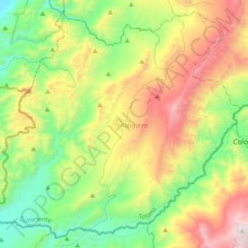
Name: Alpujarra topographic map, elevation, terrain.

Location: Alpujarra, Suroriente, Tolima, Colombia (3.27516 -75.07076 3.51112 -74.81147)

Average elevation: 1,121 m

Minimum elevation: 340 m

Maximum elevation: 2,522 m

Gear up for your next adventure:

🔋Emergency Crank Radio - Weather alerts and power without needing batteries
Lightweight Camping Tent - Portable shelter optimized for Canadian backcountry camping
🔨Vehicle Emergency Tool - Safety tool for remote road trips to trailheads
🚲MTB Frame Bag - Carry tools and maps directly on your bicycle frame
🪑Ultralight Camping Stool - Compact seating for rest stops during long hikes

As an Amazon Associate, this site earns from qualifying purchases at no extra cost to you.