Geolocate

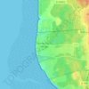
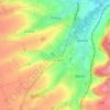
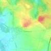
Humbert topographic map

Click on the map to display elevation.

About this map

Name: Humbert topographic map, elevation, terrain.

Location: Humbert, Montreuil-sur-Mer, Pas-de-Calais, Hauts-de-France, Metropolitan France, 62650, France (50.48445 1.89063 50.51971 1.93319)

Average elevation: 103 m

Minimum elevation: 38 m

Maximum elevation: 155 m

Other topographic maps

Click on a map to view its topography, its elevation and its terrain.

Panehem

France > Hauts-de-France > Pas-de-Calais > Samer

Average elevation: 70 m

Le Petit Vimy

France > Hauts-de-France > Pas-de-Calais > Vimy

Average elevation: 93 m

Noyelles

France > Hauts-de-France > Pas-de-Calais > Bours

Average elevation: 125 m

Gear up for your next adventure:

🥾Trail Hiking Socks - Comfortable socks to prevent blisters and fatigue
🌡️Emergency Mylar Blankets - Compact thermal protection for unexpected nights outdoors
🍽️Titanium Camping Spork - Ultralight and indestructible eating utensil
💧Hydration Bladder - Hands-free hydration solution for long treks
🔋Lithium AA Batteries - Long-lasting power that performs in extreme cold

As an Amazon Associate, this site earns from qualifying purchases at no extra cost to you.