Geolocate

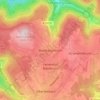
Billigheim topographic map

Click on the map to display elevation.

About this map

Name: Billigheim topographic map, elevation, terrain.

Location: Billigheim, GVV Schefflenztal, Neckar-Odenwald-Kreis, Baden-Württemberg, 74842, Germany (49.29739 9.17867 49.38170 9.31531)

Average elevation: 291 m

Minimum elevation: 165 m

Maximum elevation: 364 m

Other topographic maps

Click on a map to view its topography, its elevation and its terrain.
Gear up for your next adventure:

🔭Compact Binoculars - Lightweight optics for scouting trails and wildlife
⛺Camping Tent - Weather-resistant tents suitable for 2 to 6 people
🧭GPS Outdoor Watch - Smart watch for navigation and fitness tracking in nature
🐕Hiking Dog Pack - Let your canine companion carry their own water and food
🥾Mountain Hiking Boots - High-traction boots for rocky terrain

As an Amazon Associate, this site earns from qualifying purchases at no extra cost to you.