Geolocate

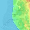
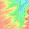
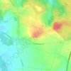
Lugy topographic map

Click on the map to display elevation.

About this map

Name: Lugy topographic map, elevation, terrain.

Location: Lugy, Montreuil-sur-Mer, Pas-de-Calais, Hauts-de-France, Metropolitan France, 62310, France (50.51099 2.15436 50.53092 2.19344)

Average elevation: 109 m

Minimum elevation: 78 m

Maximum elevation: 183 m

Other topographic maps

Click on a map to view its topography, its elevation and its terrain.

Panehem

France > Hauts-de-France > Pas-de-Calais > Samer

Average elevation: 70 m

Le Petit Vimy

France > Hauts-de-France > Pas-de-Calais > Vimy

Average elevation: 93 m

Noyelles

France > Hauts-de-France > Pas-de-Calais > Bours

Average elevation: 125 m

Gear up for your next adventure:

⛺Bushcraft Tarp - Versatile emergency shelter or gear protection
🛏️Sleeping Bag - Warm and compact sleeping bags for outdoor camping
🛌Down Sleeping Bag - Superior warmth-to-weight ratio for cold nights
💧Reusable Water Bottle - Durable water bottles for hydration on trails
🧢Sun Protection Cap - Breathable cap to protect from sun exposure

As an Amazon Associate, this site earns from qualifying purchases at no extra cost to you.