Geolocate

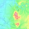
Verdivia Falls topographic map

Click on the map to display elevation.

About this map

Name: Verdivia Falls topographic map, elevation, terrain.

Location: Verdivia Falls, Doña Remedios Trinidad, Bulacan, Central Luzon, Philippines (15.09935 121.11328 15.09945 121.11338)

Average elevation: 203 m

Minimum elevation: 114 m

Maximum elevation: 336 m

Other topographic maps

Click on a map to view its topography, its elevation and its terrain.
Gear up for your next adventure:

⛺Bushcraft Tarp - Versatile emergency shelter or gear protection
🎒Fully Waterproof Backpack - Total protection for photography gear and electronics
🪑Ultralight Camping Stool - Compact seating for rest stops during long hikes
🛏️Camping Sleeping Mat - Comfortable mats for sleeping outdoors
🌬️Windproof Camp Stove - Efficient cooking even on exposed mountain peaks

As an Amazon Associate, this site earns from qualifying purchases at no extra cost to you.