Geolocate

Thorong Phedi topographic map

Click on the map to display elevation.

About this map

Name: Thorong Phedi topographic map, elevation, terrain.

Location: Thorong Phedi, Neshyang-08, Neshyang, Manang, Gandaki Province, Nepal (28.75678 83.95265 28.79678 83.99265)

Average elevation: 4,969 m

Minimum elevation: 4,301 m

Maximum elevation: 5,676 m

Other topographic maps

Click on a map to view its topography, its elevation and its terrain.
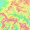
Neshyang

Nepal > Gandaki Province > Manang

Average elevation: 4,968 m

Nashong

Nepal > Gandaki Province > Manang

Average elevation: 4,661 m

Nashong

Nepal > Gandaki Province > Manang

Average elevation: 4,661 m

Neshyang

Nepal > Gandaki Province > Manang

Average elevation: 4,968 m

Neshyang-09

Nepal > Gandaki Province > Manang

Average elevation: 5,279 m

Neshyang

Nepal > Gandaki Province > Manang

Average elevation: 4,968 m

Gear up for your next adventure:

⛺Lightweight Backpacking Tent - Compact tent for efficient hiking trips
🥾Mountain Hiking Boots - High-traction boots for rocky terrain
🧥Softshell Hiking Jacket - The perfect balance of wind protection and breathability
🥾Hiking Shoes - Durable and comfortable shoes for trail hiking
🥾Mountaineering Boots - Supportive boots for climbing and high-altitude hiking

As an Amazon Associate, this site earns from qualifying purchases at no extra cost to you.