Geolocate

Magenta topographic map

Click on the map to display elevation.

About this map

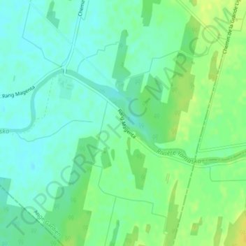
Name: Magenta topographic map, elevation, terrain.

Location: Magenta, Ange-Gardien, Rouville, Montérégie, Quebec, Canada (45.27861 -72.89730 45.29861 -72.87730)

Average elevation: 73 m

Minimum elevation: 64 m

Maximum elevation: 85 m

Rouville trails, hiking, mountain biking, running and outdoor activities

Gear up for your next adventure:

🧰Survival Kit - Essential gear for emergencies in the wilderness
🛶Kayak Accessories - Essential gear for safe and fun kayaking adventures
🧢Hiking Hat - Sun-protective and breathable hats for long treks
Bushcraft Tarp - Versatile emergency shelter or gear protection
💧Filtered Water Bottle - Safe drinking water on the go

As an Amazon Associate, this site earns from qualifying purchases at no extra cost to you.