Geolocate

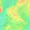
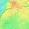
Belle-Beille topographic map

Click on the map to display elevation.

About this map

Name: Belle-Beille topographic map, elevation, terrain.

Location: Belle-Beille, Angers, Maine-et-Loire, Pays de la Loire, France métropolitaine, France (47.46477 -0.61337 47.48892 -0.56357)

Average elevation: 40 m

Minimum elevation: 12 m

Maximum elevation: 70 m

Other topographic maps

Click on a map to view its topography, its elevation and its terrain.
Frémur

France > Pays de la Loire > Maine-et-Loire > Angers

Average elevation: 29 m

Parc Balzac

France > Pays de la Loire > Maine-et-Loire > Angers

Average elevation: 31 m

Parc du Pin

France > Pays de la Loire > Maine-et-Loire > Angers

Average elevation: 39 m

Place Ney

France > Pays de la Loire > Maine-et-Loire > Angers

Average elevation: 36 m

Gear up for your next adventure:

🧥Fleece Jacket - Warm and lightweight jacket for layering
🏃Hydration Running Vest - Carry water and maps close to your body for speed
💧Collapsible Water Bottle - Space-saving water bottle for outdoor activities
🚑Survival Whistle - Signal for help across long distances in mountains
🔦LED Headtorch - Bright and durable light for night activities

As an Amazon Associate, this site earns from qualifying purchases at no extra cost to you.