
Thank you for supporting this site ❤️
Make a donation
Make a donation
Gear up for your next adventure:
As an Amazon Associate, this site earns from qualifying purchases at no extra cost to you.
Scit topographic map
Click on the map to display elevation.
Thank you for supporting this site ❤️
Make a donation
Make a donation
Gear up for your next adventure:
As an Amazon Associate, this site earns from qualifying purchases at no extra cost to you.
About this map
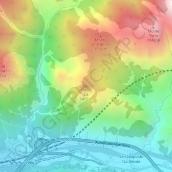
Name: Scit topographic map, elevation, terrain.
Location: Scit, Pontafel, Udine, Friaul-Julisch Venetien, 33016, Italien (46.52111 13.33706 46.52121 13.33716)
Average elevation: 1,036 m
Minimum elevation: 567 m
Maximum elevation: 1,827 m
Thank you for supporting this site ❤️
Make a donation
Make a donation
Gear up for your next adventure:
As an Amazon Associate, this site earns from qualifying purchases at no extra cost to you.