Geolocate

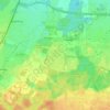
Feldkirchen topographic map

Click on the map to display elevation.

About this map
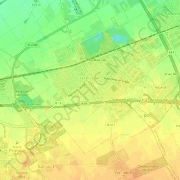
Name: Feldkirchen topographic map, elevation, terrain.

Location: Feldkirchen, Landkreis München, Bavaria, 85622, Germany (48.13266 11.70505 48.15770 11.75798)

Average elevation: 525 m

Minimum elevation: 505 m

Maximum elevation: 536 m

Other topographic maps

Click on a map to view its topography, its elevation and its terrain.
Eglfing

Germany > Bavaria > Landkreis München > Haar

Average elevation: 540 m

Martinsried

Germany > Bavaria > Landkreis München > Planegg

Average elevation: 549 m

Hofolding

Germany > Bavaria > Landkreis München

Average elevation: 609 m

Holzhausen

Germany > Bavaria > Landkreis München

Average elevation: 663 m

Deisenhofen

Germany > Bavaria > Landkreis München > Oberhaching

Average elevation: 592 m

Gear up for your next adventure:

❄️Traction Ice Cleats - Slip-on spikes for icy trails and winter hiking
🥾Mountain Hiking Boots - High-traction boots for rocky terrain
⛺Family Camping Tent - Spacious tent suitable for family camping trips
⛺Tent Footprint - Protect tent floor and increase durability
🛰️Satellite Messenger - Emergency communication for areas with no cell service

As an Amazon Associate, this site earns from qualifying purchases at no extra cost to you.