Geolocate

Winningen topographic map

Click on the map to display elevation.

About this map
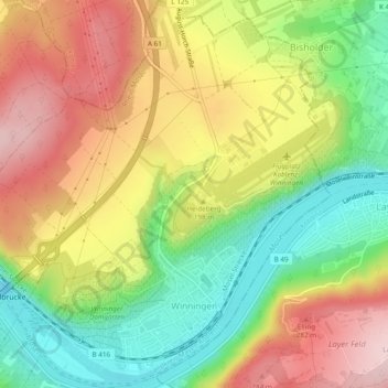
Name: Winningen topographic map, elevation, terrain.

Location: Winningen, Rhein-Mosel, Landkreis Mayen-Koblenz, Rijnland-Palts, 56333, Duitsland (50.30738 7.48800 50.33802 7.53498)

Average elevation: 180 m

Minimum elevation: 51 m

Maximum elevation: 316 m

Other topographic maps

Click on a map to view its topography, its elevation and its terrain.

Gear up for your next adventure:

⛺Camping Groundsheet - Protect your tent from moisture and dirt
🥘Camping Cookware Set - Compact nesting pots and pans for trail cooking
🥾Trekking Boots - Durable boots for long-distance trekking
🚲Heavy Duty Bike Lock - Secure your bike at the trailhead or during stops
🥾Waterproof Hiking Boots - Essential footwear for rugged terrain and wet Canadian trails

As an Amazon Associate, this site earns from qualifying purchases at no extra cost to you.