Geolocate

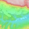
Sartaguda topographic map

Click on the map to display elevation.

About this map

Name: Sartaguda topographic map, elevation, terrain.

Location: Sartaguda, Estellerria, Navarre, 31589, Spain (42.35877 -2.06794 42.41157 -2.01619)

Average elevation: 343 m

Minimum elevation: 299 m

Maximum elevation: 451 m

Other topographic maps

Click on a map to view its topography, its elevation and its terrain.
Ecala

Spain > Navarre > Estellerria > Améscoa Baja

Average elevation: 723 m

Gear up for your next adventure:

🦶Anti-Blister Balm - Prevents friction and hotspots during long ascents
🪑Insulated Seat Pad - Protect your seat from cold rocks and wet logs
🔭Outdoor Binoculars - Lightweight binoculars for birdwatching and hiking
🧭GPS Tracker - Track your location in remote areas safely
🥾Waterproof Hiking Boots - Boots keeping your feet dry in wet conditions

As an Amazon Associate, this site earns from qualifying purchases at no extra cost to you.