
Thank you for supporting this site ❤️
Make a donation
Make a donation
Gear up for your next adventure:
As an Amazon Associate, this site earns from qualifying purchases at no extra cost to you.
Prarayer topographic map
Click on the map to display elevation.
Thank you for supporting this site ❤️
Make a donation
Make a donation
Gear up for your next adventure:
As an Amazon Associate, this site earns from qualifying purchases at no extra cost to you.
About this map
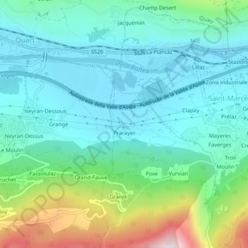
Name: Prarayer topographic map, elevation, terrain.
Location: Prarayer, Saint-Marcel, Valle d'Aosta, Italië (45.72966 7.42809 45.73380 7.43636)
Average elevation: 695 m
Minimum elevation: 519 m
Maximum elevation: 1,265 m
Thank you for supporting this site ❤️
Make a donation
Make a donation
Gear up for your next adventure:
As an Amazon Associate, this site earns from qualifying purchases at no extra cost to you.