Geolocate

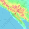
Negera Ratu Tenumbang topographic map

Click on the map to display elevation.

About this map

Name: Negera Ratu Tenumbang topographic map, elevation, terrain.

Location: Negera Ratu Tenumbang, Pesisir Barat, Lampung, Indonesia (-5.23059 104.03138 -5.19059 104.07138)

Average elevation: 194 m

Minimum elevation: 29 m

Maximum elevation: 347 m

Other topographic maps

Click on a map to view its topography, its elevation and its terrain.
Gear up for your next adventure:

🧊Insulated Water Bottle - Keeps drinks cold in summer and prevents freezing in winter
🚑Survival Whistle - Signal for help across long distances in mountains
🧳Compression Sacks - Maximize space in your backpack by shrinking gear
🔥Camping Stove - Portable stoves to cook outdoors with ease
🥾Durable Hiking Shoes - Long-lasting shoes for frequent hiking

As an Amazon Associate, this site earns from qualifying purchases at no extra cost to you.