Geolocate

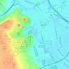
Al Ayyat topographic map

Click on the map to display elevation.

About this map

Name: Al Ayyat topographic map, elevation, terrain.

Location: Al Ayyat, Aj Jiza, 12929, Egypt (29.57958 31.21813 29.65958 31.29813)

Average elevation: 24 m

Minimum elevation: 9 m

Maximum elevation: 52 m

Other topographic maps

Click on a map to view its topography, its elevation and its terrain.

Geziret el Dahab

Egypt > Aj Jiza > Giza

Average elevation: 23 m

Nazlet Al Siman and Al Sisi

Egypt > Aj Jiza > Giza

Average elevation: 42 m

Al Ayat City

Egypt > Aj Jiza

Average elevation: 23 m

Memphis

Egypt > Aj Jiza > Mit Rahinah

Average elevation: 23 m

Gear up for your next adventure:

🧥Softshell Jacket - Windproof and breathable jacket for hiking
🎒Backpack Rain Cover - External shield to keep your entire pack dry
💡LED Headlamp - Hands-free illumination for night hiking and camping
💧Hydration Pack - Hands-free hydration system for long hikes
🏕️Camping Hammock - Integrated protection for sleeping between trees

As an Amazon Associate, this site earns from qualifying purchases at no extra cost to you.