Geolocate

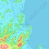
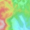
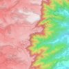
Lages topographic map

Click on the map to display elevation.

About this map

Name: Lages topographic map, elevation, terrain.

Location: Lages, Santa Catarina, South Region, Brazil (-28.43334 -50.69641 -27.56908 -49.99821)

Average elevation: 1,011 m

Minimum elevation: 631 m

Maximum elevation: 1,721 m

Other topographic maps

Click on a map to view its topography, its elevation and its terrain.
Três Picos

Brazil > Santa Catarina

Average elevation: 795 m

Residência Fuck

Brazil > Santa Catarina > Monte Castelo

Average elevation: 845 m

Córrego do Fuck

Brazil > Santa Catarina > Canoinhas

Average elevation: 786 m

Serra da Bateia

Brazil > Santa Catarina > Guabiruba

Average elevation: 339 m

Alto Pitanga

Brazil > Santa Catarina > Nova Trento

Average elevation: 427 m

Palhocinha

Brazil > Santa Catarina > Trombudo Central

Average elevation: 391 m

Pericó

Brazil > Santa Catarina > São Joaquim

Average elevation: 1,239 m

Gear up for your next adventure:

🧢Beanie Hat - Keep your head warm in cold weather
🧰Survival Kit - Essential gear for emergencies in the wilderness
🔦LED Headlamp - Hands-free lighting for early morning starts or late finishes
🔪Outdoor Multitool - Versatile tool for repairs and food prep in the wild
👖Convertible Hiking Pants - Zip-off legs to adapt to changing weather conditions

As an Amazon Associate, this site earns from qualifying purchases at no extra cost to you.