Geolocate

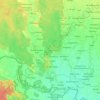
Gadi topographic map

Click on the map to display elevation.

About this map

Name: Gadi topographic map, elevation, terrain.

Location: Gadi, Joshipur, Kailali, Sudurpashchim Province, Nepal (28.56950 81.00097 28.60950 81.04097)

Average elevation: 155 m

Minimum elevation: 150 m

Maximum elevation: 160 m

Other topographic maps

Click on a map to view its topography, its elevation and its terrain.

Chure

Nepal > Sudurpashchim Province > Kailali

Average elevation: 939 m

Bhajani

Nepal > Sudurpashchim Province > Kailali

Average elevation: 152 m

Bhajani

Nepal > Sudurpashchim Province > Kailali

Average elevation: 152 m

Gear up for your next adventure:

🧤Insulated Winter Gloves - Heavy-duty protection for sub-zero Canadian adventures
🦯Trekking Poles - Reduced impact on joints for steep topographic climbs
🧴Sunscreen SPF - Broad-spectrum sunscreen for outdoor activities
🛶Kayak Dry Bag - Waterproof storage for kayaking adventures
🔥Emergency Fire Starter - Reliable ignition source for all weather conditions

As an Amazon Associate, this site earns from qualifying purchases at no extra cost to you.