Geolocate

Kopani topographic map

Click on the map to display elevation.

About this map

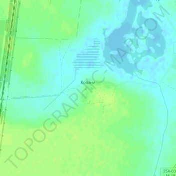
Name: Kopani topographic map, elevation, terrain.

Location: Kopani, Ермаковское сельское поселение, Ukraine (45.84482 34.45537 45.85052 34.46956)

Average elevation: 6 m

Minimum elevation: -3 m

Maximum elevation: 13 m

Gear up for your next adventure:

🔥Emergency Fire Starter - Reliable ignition source for all weather conditions
🌡️Emergency Mylar Blankets - Compact thermal protection for unexpected nights outdoors
🥾Trekking Poles - Adjustable trekking poles to reduce knee stress and improve stability
Camping Groundsheet - Protect your tent from moisture and dirt
🎒Backpack Rain Cover - External shield to keep your entire pack dry

As an Amazon Associate, this site earns from qualifying purchases at no extra cost to you.