Geolocate

Pindarsi topographic map

Click on the map to display elevation.

About this map

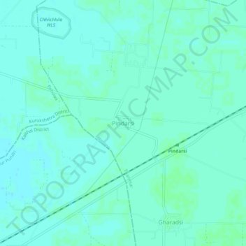
Name: Pindarsi topographic map, elevation, terrain.

Location: Pindarsi, Thanesar, Kurukshetra District, Haryana, India (29.90190 76.67447 29.94190 76.71447)

Average elevation: 250 m

Minimum elevation: 247 m

Maximum elevation: 252 m

Other topographic maps

Click on a map to view its topography, its elevation and its terrain.

Chhilchhila WLS

India > Haryana > Thanesar

Average elevation: 250 m

Palwal

India > Haryana > Thanesar

Average elevation: 258 m

Gear up for your next adventure:

🧴Bear Spray Holster - Quick-access carry for essential Canadian wilderness safety
🥾Trail Hiking Shoes - Durable shoes designed for rugged trails
🧼Travel Hand Sanitizer - Keep hands clean when water is scarce
🔋Emergency Crank Radio - Weather alerts and power without needing batteries
💧Collapsible Water Bottle - Space-saving water bottle for outdoor activities

As an Amazon Associate, this site earns from qualifying purchases at no extra cost to you.