Geolocate

La Roca topographic map

Click on the map to display elevation.

About this map

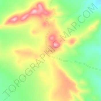
Name: La Roca topographic map, elevation, terrain.

Location: La Roca, Cuencamé, Durango, Mexico (24.43872 -103.72683 24.47872 -103.68683)

Average elevation: 2,173 m

Minimum elevation: 2,085 m

Maximum elevation: 2,268 m

Gear up for your next adventure:

Camping Coffee Maker - Brew fresh coffee anywhere on the topographic map
🧴Outdoor Sunscreen - High SPF protection for high-altitude UV exposure
❄️Traction Ice Cleats - Slip-on spikes for icy trails and winter hiking
🧦Hiking Liner Socks - Thin base layer to prevent friction and blisters
🥾Light Trekking Boots - Supportive boots for multi-day treks

As an Amazon Associate, this site earns from qualifying purchases at no extra cost to you.