
Westuffeln topographic map
Interactive map
Click on the map to display elevation.
About this map
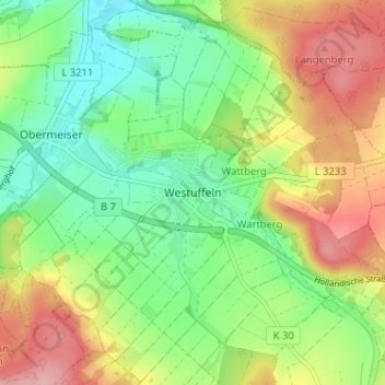
Name: Westuffeln topographic map, elevation, terrain.
Location: Westuffeln, Landkreis Kassel, Hessen, 34379, Deutschland (51.41538 9.30589 51.45538 9.34589)
Average elevation: 227 m
Minimum elevation: 168 m
Maximum elevation: 310 m