
České Budějovice topographic map
Interactive map
Click on the map to display elevation.
About this map
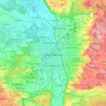
Name: České Budějovice topographic map, elevation, terrain.
Location: České Budějovice, okres České Budějovice, Southwest, Czechia (48.93343 14.38692 49.01986 14.59519)
Average elevation: 437 m
Minimum elevation: 370 m
Maximum elevation: 579 m
Other topographic maps
Click on a map to view its topography, its elevation and its terrain.