Geolocate

Malassa topographic map

Click on the map to display elevation.

About this map

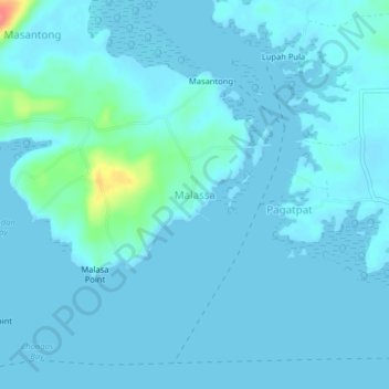
Name: Malassa topographic map, elevation, terrain.

Location: Malassa, Bongao, Tawi-Tawi, Bangsamoro, Philippines (5.04037 119.79237 5.08037 119.83237)

Average elevation: 6 m

Minimum elevation: 0 m

Maximum elevation: 67 m

Gear up for your next adventure:

🧢Outdoor Cap - Protective cap for sun and rain during hikes
💧Reusable Water Bottle - Durable water bottles for hydration on trails
🥾Light Hiking Boots - Lightweight and comfortable boots for day hikes
🧼Travel Hand Sanitizer - Keep hands clean when water is scarce
🧢Sun Hat - Wide-brim hat for sun protection

As an Amazon Associate, this site earns from qualifying purchases at no extra cost to you.