Geolocate

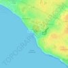
Beaumont topographic map

Click on the map to display elevation.

About this map

Name: Beaumont topographic map, elevation, terrain.

Location: Beaumont, Château-d'Olonne, Les Sables-d'Olonne, Vendée, Pays de la Loire, France métropolitaine, 85180, France (46.48862 -1.73578 46.52862 -1.69578)

Average elevation: 41 m

Minimum elevation: 11 m

Maximum elevation: 62 m

Other topographic maps

Click on a map to view its topography, its elevation and its terrain.

85180

France > Pays de la Loire > Vendée > Les Sables-d'Olonne

Average elevation: 28 m

Gear up for your next adventure:

🧴Bear Spray Holster - Quick-access carry for essential Canadian wilderness safety
🧊Insulated Water Bottle - Keeps drinks cold in summer and prevents freezing in winter
🕯️Camping Lantern - Illuminates your entire campsite with high-efficiency LEDs
🔭Compact Binoculars - Lightweight optics for scouting trails and wildlife
🥽Outdoor Goggles - Protective eyewear for outdoor activities

As an Amazon Associate, this site earns from qualifying purchases at no extra cost to you.