Geolocate

Gem topographic map

Click on the map to display elevation.

About this map

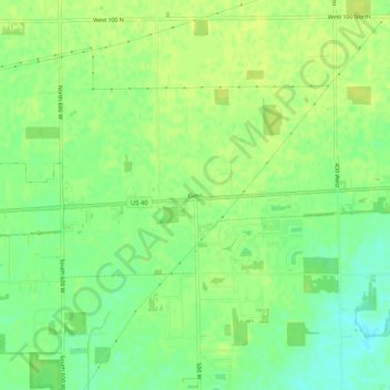
Name: Gem topographic map, elevation, terrain.

Location: Gem, Hancock County, Indiana, 46163, United States (39.75978 -85.91665 39.79978 -85.87665)

Average elevation: 261 m

Minimum elevation: 251 m

Maximum elevation: 266 m

Other topographic maps

Click on a map to view its topography, its elevation and its terrain.

Fortville

United States > Indiana > Hancock County

Average elevation: 263 m

Wilkinson

United States > Indiana > Hancock County

Average elevation: 307 m

Spring Lake

United States > Indiana > Hancock County

Average elevation: 259 m

New Palestine

United States > Indiana > Hancock County

Average elevation: 253 m

Cumberland

United States > Indiana > Hancock County

Average elevation: 261 m

Gear up for your next adventure:

🦶Hiking Shoe Insoles - Added support for high arches and long days on feet
🥾Lightweight Hiking Boots - Boots for comfort and mobility on long hikes
🧦Outdoor Socks - Durable socks designed for hiking and outdoor sports
🥾Waterproof Hiking Shoes - Durable shoes for wet and rugged trails
🥾Hiking Gaiters - Protect legs and shoes from mud, snow, and debris

As an Amazon Associate, this site earns from qualifying purchases at no extra cost to you.