Geolocate

Sarikei topographic map

Click on the map to display elevation.

About this map

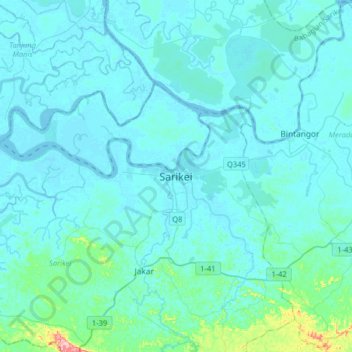
Name: Sarikei topographic map, elevation, terrain.

Location: Sarikei, Sarikei Division, Sarawak, 96107, Malaysia (1.96948 111.36306 2.28948 111.68306)

Average elevation: 14 m

Minimum elevation: -6 m

Maximum elevation: 183 m

Gear up for your next adventure:

💡Solar Camping Lamp - Eco-friendly lighting for campsites
🧢Hiking Sun Hat - Wide-brimmed protection for exposed mountain ridges
🪑Insulated Seat Pad - Protect your seat from cold rocks and wet logs
🛁Quick-Dry Microfiber Towel - Space-saving towel that dries rapidly on the move
🔋Emergency Crank Radio - Weather alerts and power without needing batteries

As an Amazon Associate, this site earns from qualifying purchases at no extra cost to you.