Geolocate

Rogaro topographic map

Click on the map to display elevation.

About this map
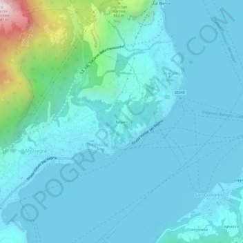
Name: Rogaro topographic map, elevation, terrain.

Location: Rogaro, Tremezzo, Tremezzina, Como, Lombardia, 22016, Italia (45.96722 9.20429 46.00722 9.24429)

Average elevation: 366 m

Minimum elevation: 184 m

Maximum elevation: 1,631 m

Gear up for your next adventure:

🧥Softshell Jacket - Windproof and breathable jacket for hiking
🪑Insulated Seat Pad - Protect your seat from cold rocks and wet logs
🧥Softshell Hiking Jacket - The perfect balance of wind protection and breathability
🔦UV Flashlight - Detect minerals or specific insects in the dark
🧥Waterproof Jacket - Lightweight rain jackets for hiking and outdoor activities

As an Amazon Associate, this site earns from qualifying purchases at no extra cost to you.