Geolocate

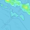
Kergrippe topographic map

Click on the map to display elevation.

About this map

Name: Kergrippe topographic map, elevation, terrain.

Location: Kergrippe, Séné, Vannes, Morbihan, Bretagne, France métropolitaine, 56860, France (47.60407 -2.75056 47.64407 -2.71056)

Average elevation: 4 m

Minimum elevation: -3 m

Maximum elevation: 24 m

Other topographic maps

Click on a map to view its topography, its elevation and its terrain.

Parc de Limur

France > Bretagne > Morbihan > Séné > Limur

Average elevation: 11 m

Île de Boëde

France > Bretagne > Morbihan > Séné > Le Badel

Average elevation: 2 m

Gear up for your next adventure:

🥾Durable Hiking Shoes - Long-lasting shoes for frequent hiking
🏕️Camping Hammock - Integrated protection for sleeping between trees
🧴First Aid Kit - Essential first aid supplies for outdoor emergencies
🧼Travel Hand Sanitizer - Keep hands clean when water is scarce
🧼Biodegradable Camp Soap - Environmentally friendly cleaning for gear and body

As an Amazon Associate, this site earns from qualifying purchases at no extra cost to you.