Geolocate

Igtuble topographic map

Click on the map to display elevation.

About this map

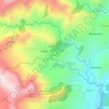
Name: Igtuble topographic map, elevation, terrain.

Location: Igtuble, Tubungan, Iloilo, Western Visayas, Philippines (10.80489 122.24712 10.84489 122.28712)

Average elevation: 548 m

Minimum elevation: 167 m

Maximum elevation: 1,059 m

Gear up for your next adventure:

🧤Thermal Hiking Gloves - Grip-enhanced gloves for cold-weather altitude trekking
🧭GPS Handheld Device - Reliable GPS navigation for outdoor adventures
Camping Essentials - All-in-one gear for a comfortable camping trip
🏃Hydration Running Vest - Carry water and maps close to your body for speed
💡Portable Camping Lamp - Rechargeable lamp for campsite lighting

As an Amazon Associate, this site earns from qualifying purchases at no extra cost to you.