Geolocate

Chitkul topographic map

Click on the map to display elevation.

About this map

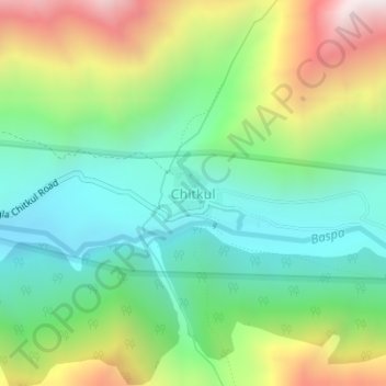
Name: Chitkul topographic map, elevation, terrain.

Location: Chitkul, Sangla, Kinnaur District, Himachal Pradesh, India (31.35005 78.43385 31.35368 78.43830)

Average elevation: 3,695 m

Minimum elevation: 3,323 m

Maximum elevation: 4,392 m

Gear up for your next adventure:

🏃Hydration Running Vest - Carry water and maps close to your body for speed
💡Solar Camping Lamp - Eco-friendly lighting for campsites
🥾Approach Boots - Comfortable boots for hiking and climbing approaches
🥾Waterproof Hiking Shoes - Durable shoes for wet and rugged trails
🦶Hiking Shoe Insoles - Added support for high arches and long days on feet

As an Amazon Associate, this site earns from qualifying purchases at no extra cost to you.