Geolocate

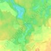
Joachimsthal topographic map

Click on the map to display elevation.

About this map

Name: Joachimsthal topographic map, elevation, terrain.

Location: Joachimsthal, Joachimsthal (Schorfheide), Barnim, Brandenburg, 16247, Duitsland (52.90154 13.60202 53.02953 13.82844)

Average elevation: 71 m

Minimum elevation: 39 m

Maximum elevation: 123 m

Other topographic maps

Click on a map to view its topography, its elevation and its terrain.
Lagersee

Duitsland > Brandenburg > Barnim > Biesenthal-Barnim

Average elevation: 66 m

Gear up for your next adventure:

💧Hydration Pack - Hands-free hydration system for long hikes
🥾All-Terrain Hiking Boots - Versatile boots for varied hiking conditions
🦟Insect Repellent - Keep mosquitoes and black flies away in wooded areas
🔋Solar Power Bank - Keep your GPS and devices charged during long outdoor trips
🧢Outdoor Cap - Protective cap for sun and rain during hikes

As an Amazon Associate, this site earns from qualifying purchases at no extra cost to you.