Geolocate

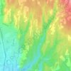
Duno topographic map

Click on the map to display elevation.

About this map

Name: Duno topographic map, elevation, terrain.

Location: Duno, Comunità Montana Valli del Verbano, Varese, Lombardy, Italy (45.91018 8.72179 45.93028 8.74687)

Average elevation: 665 m

Minimum elevation: 265 m

Maximum elevation: 1,166 m

Other topographic maps

Click on a map to view its topography, its elevation and its terrain.

Due Cossani

Italy > Lombardy > Varese

Average elevation: 599 m

Santa Maria del monte

Italy > Lombardy > Varese > Varese

Average elevation: 689 m

Case Nuove

Italy > Lombardy > Varese > Somma Lombardo

Average elevation: 218 m

Pianbosco

Italy > Lombardy > Varese > Venegono Inferiore

Average elevation: 368 m

Vizzola Ticino

Italy > Lombardy > Varese > Vizzola Ticino

Average elevation: 197 m

Gear up for your next adventure:

🛁Quick-Dry Microfiber Towel - Space-saving towel that dries rapidly on the move
☕Camping Coffee Maker - Brew fresh coffee anywhere on the topographic map
🦌Outdoor Trail Camera - Monitor wildlife activity near your favorite spots
🔦LED Flashlight - Powerful and long-lasting flashlight for camping and emergencies
🏃Hydration Running Vest - Carry water and maps close to your body for speed

As an Amazon Associate, this site earns from qualifying purchases at no extra cost to you.