Geolocate

Jawor topographic map

Click on the map to display elevation.

About this map

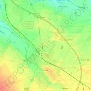
Name: Jawor topographic map, elevation, terrain.

Location: Jawor, Jawor County, Lower Silesian Voivodeship, Poland (51.03597 16.14112 51.09940 16.22907)

Average elevation: 193 m

Minimum elevation: 168 m

Maximum elevation: 216 m

Gear up for your next adventure:

🎒Hiking Backpack - Lightweight and ergonomic backpacks for day hikes or multi-day treks
🧴Sunscreen SPF - Broad-spectrum sunscreen for outdoor activities
Backpacking Tent - Lightweight tent for long-distance hiking trips
🔦LED Headtorch - Bright and durable light for night activities
🧤Rechargeable Heated Gloves - Extreme warmth for Canadian winter expeditions

As an Amazon Associate, this site earns from qualifying purchases at no extra cost to you.