Geolocate

Caset topographic map

Click on the map to display elevation.

About this map

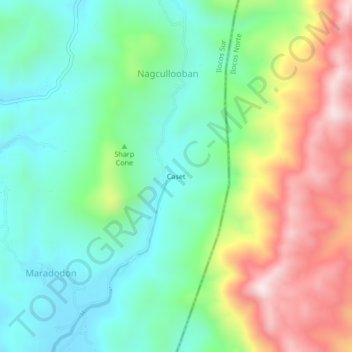
Name: Caset topographic map, elevation, terrain.

Location: Caset, Nagcullooban, Ilocos Sur, Ilocos Region, Philippines (17.80990 120.50286 17.84990 120.54286)

Average elevation: 251 m

Minimum elevation: 52 m

Maximum elevation: 623 m

Gear up for your next adventure:

🧼Biodegradable Camp Soap - Environmentally friendly cleaning for gear and body
👟Sport Hiking Sandals - Breathable footwear for water crossings and camp rest
🛏️Camping Sleeping Mat - Comfortable mats for sleeping outdoors
🧢Outdoor Visor - Breathable visor for sunny hikes
🦶Hiking Shoe Insoles - Added support for high arches and long days on feet

As an Amazon Associate, this site earns from qualifying purchases at no extra cost to you.