Geolocate

Farur topographic map

Click on the map to display elevation.

About this map

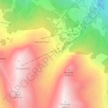
Name: Farur topographic map, elevation, terrain.

Location: Farur, Tschiertschen-Praden, Plessur, Grisons, 7064, Switzerland (46.78902 9.58554 46.80902 9.60554)

Average elevation: 1,965 m

Minimum elevation: 1,309 m

Maximum elevation: 2,439 m

Gear up for your next adventure:

🧥Packable Rain Jacket - Breathable waterproof layer for unpredictable weather
🧴Sunscreen SPF - Broad-spectrum sunscreen for outdoor activities
🥘Camping Cookware Set - Compact nesting pots and pans for trail cooking
🔦LED Flashlight - Powerful and long-lasting flashlight for camping and emergencies
🥾Lightweight Hiking Shoes - Comfortable shoes for day hikes

As an Amazon Associate, this site earns from qualifying purchases at no extra cost to you.