Geolocate

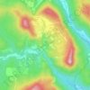
Bernedo topographic map

Click on the map to display elevation.

About this map

Name: Bernedo topographic map, elevation, terrain.

Location: Bernedo, Montaña Alavesa, Álava, País Vasco, España (42.60817 -2.60903 42.78868 -2.41697)

Average elevation: 801 m

Minimum elevation: 563 m

Maximum elevation: 1,293 m

Other topographic maps

Click on a map to view its topography, its elevation and its terrain.
Orbiso

España > País Vasco > Montaña Alavesa > Campezo

Average elevation: 637 m

Corres

España > País Vasco > Montaña Alavesa

Average elevation: 745 m

El Onzal

España > País Vasco > Montaña Alavesa > Campezo

Average elevation: 612 m

Onraita

España > País Vasco > Montaña Alavesa

Average elevation: 926 m

Maestu

España > País Vasco > Montaña Alavesa

Average elevation: 717 m

Bujanda

España > País Vasco > Montaña Alavesa > Campezo

Average elevation: 683 m

Gear up for your next adventure:

🧥Softshell Hiking Jacket - The perfect balance of wind protection and breathability
☕Camping Coffee Maker - Brew fresh coffee anywhere on the topographic map
🧤Insulated Winter Gloves - Heavy-duty protection for sub-zero Canadian adventures
🪑Insulated Seat Pad - Protect your seat from cold rocks and wet logs
🕯️Camping Lantern - Illuminates your entire campsite with high-efficiency LEDs

As an Amazon Associate, this site earns from qualifying purchases at no extra cost to you.