Geolocate

Pila topographic map

Click on the map to display elevation.

About this map

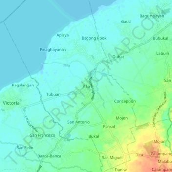
Name: Pila topographic map, elevation, terrain.

Location: Pila, Laguna, Calabarzon, 4010, Philippines (14.19473 121.32406 14.27473 121.40406)

Average elevation: 11 m

Minimum elevation: -5 m

Maximum elevation: 53 m

Gear up for your next adventure:

🥾Waterproof Hiking Boots - Boots keeping your feet dry in wet conditions
Camping Groundsheet - Protect your tent from moisture and dirt
🥾Lightweight Hiking Boots - Boots for comfort and mobility on long hikes
💡Solar Camping Lamp - Eco-friendly lighting for campsites
Family Camping Tent - Spacious tent suitable for family camping trips

As an Amazon Associate, this site earns from qualifying purchases at no extra cost to you.