Geolocate

Kahla topographic map

Click on the map to display elevation.

About this map

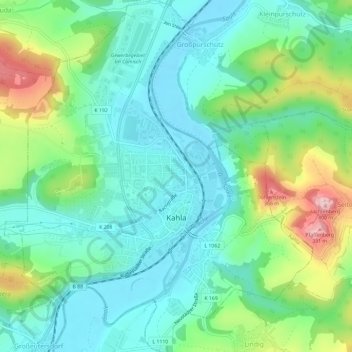
Name: Kahla topographic map, elevation, terrain.

Location: Kahla, Saale-Holzland-Kreis, Thuringia, 07768, Germany (50.78838 11.55890 50.82555 11.61058)

Average elevation: 223 m

Minimum elevation: 156 m

Maximum elevation: 393 m

Gear up for your next adventure:

💧Hydration Pack - Hands-free hydration system for long hikes
🎒Fully Waterproof Backpack - Total protection for photography gear and electronics
🥾Trekking Poles - Adjustable trekking poles to reduce knee stress and improve stability
🚲MTB Frame Bag - Carry tools and maps directly on your bicycle frame
🥾All-Terrain Hiking Boots - Versatile boots for varied hiking conditions

As an Amazon Associate, this site earns from qualifying purchases at no extra cost to you.