Geolocate

Greenpark topographic map

Click on the map to display elevation.

About this map

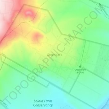
Name: Greenpark topographic map, elevation, terrain.

Location: Greenpark, Malewa West ward, Gilgil, Nakuru, Kenya (-0.68534 36.28084 -0.64534 36.32084)

Average elevation: 2,123 m

Minimum elevation: 1,972 m

Maximum elevation: 2,393 m

Gear up for your next adventure:

🧊Insulated Water Bottle - Keeps drinks cold in summer and prevents freezing in winter
🎒Fully Waterproof Backpack - Total protection for photography gear and electronics
🧥Waterproof Pants - Keep dry during rainy hiking conditions
🧴Bear Spray Holster - Quick-access carry for essential Canadian wilderness safety
🥾Hiking Boots - Sturdy boots providing ankle support and traction on rugged trails

As an Amazon Associate, this site earns from qualifying purchases at no extra cost to you.