Geolocate

Buenos topographic map

Click on the map to display elevation.

About this map

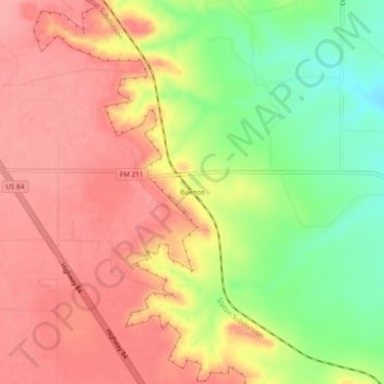
Name: Buenos topographic map, elevation, terrain.

Location: Buenos, Garza County, Texas, United States (33.27926 -101.50765 33.31926 -101.46765)

Average elevation: 876 m

Minimum elevation: 815 m

Maximum elevation: 916 m

Gear up for your next adventure:

🐕Hiking Dog Pack - Let your canine companion carry their own water and food
🏕️Camping Hammock - Integrated protection for sleeping between trees
🛶Kayak Dry Bag - Waterproof storage for kayaking adventures
🥾Mountain Hiking Shoes - Shoes with superior grip for mountainous terrain
🧥Packable Rain Jacket - Breathable waterproof layer for unpredictable weather

As an Amazon Associate, this site earns from qualifying purchases at no extra cost to you.