Geolocate

Oco topographic map

Click on the map to display elevation.

About this map

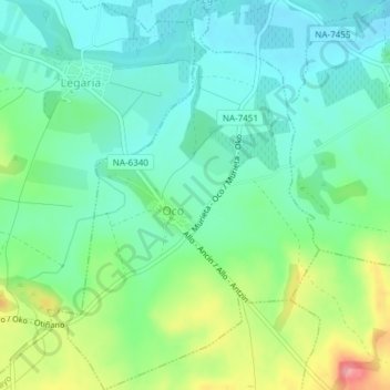
Name: Oco topographic map, elevation, terrain.

Location: Oco, Estellerria, Navarre, Spain (42.62645 -2.17698 42.65406 -2.15082)

Average elevation: 491 m

Minimum elevation: 461 m

Maximum elevation: 564 m

Other topographic maps

Click on a map to view its topography, its elevation and its terrain.

Ecala

Spain > Navarre > Estellerria > Améscoa Baja

Average elevation: 723 m

Gear up for your next adventure:

📷Outdoor Action Camera - Capture high-elevation views and rugged adventures
🔨Vehicle Emergency Tool - Safety tool for remote road trips to trailheads
🍽️Titanium Camping Spork - Ultralight and indestructible eating utensil
🥾Mountain Hiking Boots - High-traction boots for rocky terrain
🌬️Windproof Camp Stove - Efficient cooking even on exposed mountain peaks

As an Amazon Associate, this site earns from qualifying purchases at no extra cost to you.