Geolocate

Hambabauran topographic map

Click on the map to display elevation.

About this map

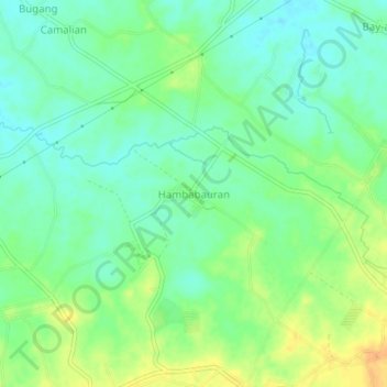
Name: Hambabauran topographic map, elevation, terrain.

Location: Hambabauran, Ubay, Bohol, Central Visayas, Philippines (9.98126 124.39419 10.02126 124.43419)

Average elevation: 22 m

Minimum elevation: 9 m

Maximum elevation: 42 m

Other topographic maps

Click on a map to view its topography, its elevation and its terrain.

Cebucawan Island

Philippines > Bohol > Ubay

Average elevation: 1 m

Gear up for your next adventure:

🥾Hiking Leggings - Comfortable leggings for outdoor activities
❄️Traction Ice Cleats - Slip-on spikes for icy trails and winter hiking
Tent Footprint - Protect tent floor and increase durability
🧼Travel Hand Sanitizer - Keep hands clean when water is scarce
🧊Insulated Water Bottle - Keeps drinks cold in summer and prevents freezing in winter

As an Amazon Associate, this site earns from qualifying purchases at no extra cost to you.