
Thank you for supporting this site ❤️
Make a donation
Make a donation
Gear up for your next adventure:
As an Amazon Associate, this site earns from qualifying purchases at no extra cost to you.
Canadello topographic map
Click on the map to display elevation.
Thank you for supporting this site ❤️
Make a donation
Make a donation
Gear up for your next adventure:
As an Amazon Associate, this site earns from qualifying purchases at no extra cost to you.
About this map
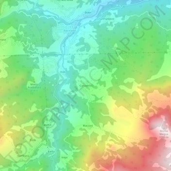
Name: Canadello topographic map, elevation, terrain.
Location: Canadello, Ferriere, Piacenza, Emilia-Romagna, 29024, Italia (44.61130 9.48266 44.65130 9.52266)
Average elevation: 850 m
Minimum elevation: 581 m
Maximum elevation: 1,355 m
Thank you for supporting this site ❤️
Make a donation
Make a donation
Gear up for your next adventure:
As an Amazon Associate, this site earns from qualifying purchases at no extra cost to you.