Geolocate

Albe topographic map

Click on the map to display elevation.

About this map

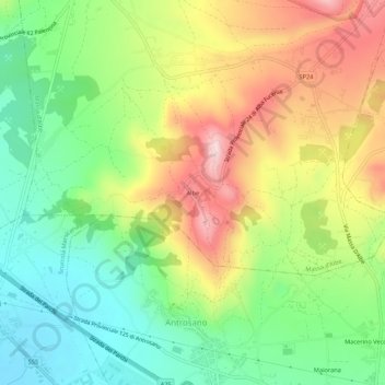
Name: Albe topographic map, elevation, terrain.

Location: Albe, Massa d'Albe, L'Aquila, 67068, Italy (42.06010 13.38902 42.10010 13.42902)

Average elevation: 836 m

Minimum elevation: 701 m

Maximum elevation: 1,019 m

Gear up for your next adventure:

🕶️Polarized Sunglasses - Protect your eyes with durable polarized lenses
Camping Tent - Weather-resistant tents suitable for 2 to 6 people
🧦Hiking Liner Socks - Thin base layer to prevent friction and blisters
🥾All-Terrain Hiking Boots - Versatile boots for varied hiking conditions
🥾Lightweight Hiking Shoes - Comfortable shoes for day hikes

As an Amazon Associate, this site earns from qualifying purchases at no extra cost to you.