El Refugio topographic map
Interactive map
Click on the map to display elevation.
About this map
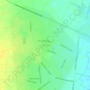
Name: El Refugio topographic map, elevation, terrain.
Average elevation: 1,007 m
Minimum elevation: 997 m
Maximum elevation: 1,018 m

Click on the map to display elevation.
Name: El Refugio topographic map, elevation, terrain.
Average elevation: 1,007 m
Minimum elevation: 997 m
Maximum elevation: 1,018 m