
Thank you for supporting this site ❤️
Make a donation
Make a donation
Gear up for your next adventure:
As an Amazon Associate, this site earns from qualifying purchases at no extra cost to you.
Slai Al-Ghalib topographic map
Click on the map to display elevation.
Thank you for supporting this site ❤️
Make a donation
Make a donation
Gear up for your next adventure:
As an Amazon Associate, this site earns from qualifying purchases at no extra cost to you.
About this map
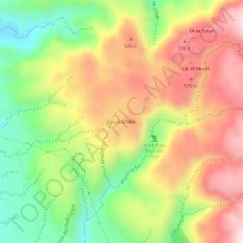
Name: Slai Al-Ghalib topographic map, elevation, terrain.
Location: Slai Al-Ghalib, Ras al-Khaimah Emirate, United Arab Emirates (25.72410 56.04133 25.76410 56.08133)
Average elevation: 388 m
Minimum elevation: 74 m
Maximum elevation: 700 m
Thank you for supporting this site ❤️
Make a donation
Make a donation
Gear up for your next adventure:
As an Amazon Associate, this site earns from qualifying purchases at no extra cost to you.
Other topographic maps
Click on a map to view its topography, its elevation and its terrain.