
Clusaz topographic map
Interactive map
Click on the map to display elevation.
About this map
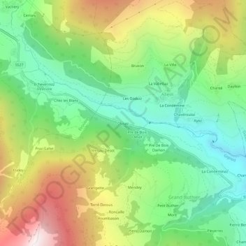
Name: Clusaz topographic map, elevation, terrain.
Location: Clusaz, Grand Buthier, Gignod, Vallée d'Aoste, 11014, Italie (45.78313 7.24216 45.82313 7.28216)
Average elevation: 1,485 m
Minimum elevation: 932 m
Maximum elevation: 2,359 m
Other topographic maps
Click on a map to view its topography, its elevation and its terrain.
Moré
Italie > Vallée d'Aoste > Grand Buthier
Moré, Grand Buthier, Gignod, Vallée d'Aoste, Italie
Average elevation: 1,411 m