
Make a donation
Gear up for your next adventure:
As an Amazon Associate, this site earns from qualifying purchases at no extra cost to you.
Portsloge topographic map
Click on the map to display elevation.
Make a donation
Gear up for your next adventure:
As an Amazon Associate, this site earns from qualifying purchases at no extra cost to you.
Portsloge
Der Erste Weltkrieg unterbrach die Ortsentwicklung. Viele Männer wurden zum Wehrdienst eingezogen, ab 1915 begannen Rationierungen und eine Abgabepflicht für Vieh und Getreide. 20 Portsloger Soldaten fielen im Krieg. Die Bedingungen des als „Diktatfrieden“ empfundenen Versailler Vertrages bilden auch in Portsloge eine Wurzel des aufkommenden Nationalsozialismus. Reparationszahlungen und Inflation ließen das Wirtschaftsleben erlahmen. Daher erfolgten als Arbeitsbeschaffung zwischen 1925 und 1930 großflächige Waldholzungen am Brannwisch (etwa 70 – 80 Hektar). Auf dem Höhepunkt der Weltwirtschaftskrise 1929 hatte Portsloge 350 Einwohner int 73 Wohnhäusern. Es herrschte hohe Arbeitslosigkeit. Die landwirtschaftlichen Preise waren durch Billigimporte unter starkem Druck und Pfändungen gehörten zum Alltag.
Make a donation
Gear up for your next adventure:
As an Amazon Associate, this site earns from qualifying purchases at no extra cost to you.
About this map
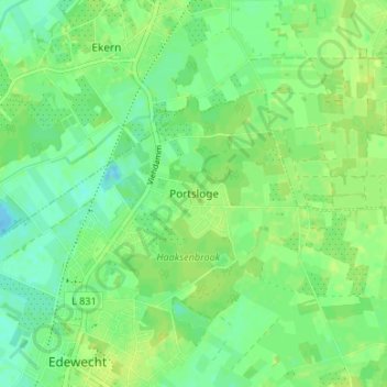
Name: Portsloge topographic map, elevation, terrain.
Average elevation: 8 m
Minimum elevation: -14 m
Maximum elevation: 14 m
Make a donation
Gear up for your next adventure:
As an Amazon Associate, this site earns from qualifying purchases at no extra cost to you.
Other topographic maps
Click on a map to view its topography, its elevation and its terrain.
26188
Deutschland > Niedersachsen > Landkreis Ammerland > Edewecht > Jeddeloh I
Average elevation: 8 m