
Rau Teeba topographic map
Click on the map to display elevation.
About this map
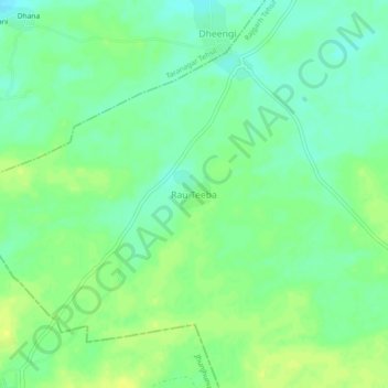
Name: Rau Teeba topographic map, elevation, terrain.
Location: Rau Teeba, Rajgarh Tehsil, Churu, Rajasthan, 331026, India (28.44522 75.25773 28.48522 75.29773)
Average elevation: 266 m
Minimum elevation: 257 m
Maximum elevation: 275 m
Other topographic maps
Click on a map to view its topography, its elevation and its terrain.
Sadulpur
India > Rajasthan > Rajgarh Tehsil
Sadulpur, natively known as Rajgarh is a city, municipality, tehsil and Legislative Assembly seat in Churu district of northern part of Rajasthan state in India. It was the territory of the Gaur dynasty later after defeated in war with Shekhawat Rajputs. It lies in Shekhawati region at an elevation of 239 m…
Average elevation: 240 m