Geolocate

Bandipur topographic map

Click on the map to display elevation.

About this map

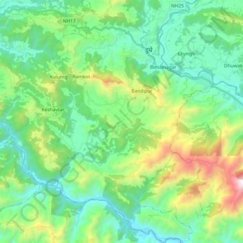
Name: Bandipur topographic map, elevation, terrain.

Location: Bandipur, Tanahun, Gandaki Pradesh, 00000, Nepal (27.84264 84.34249 27.99457 84.45789)

Average elevation: 698 m

Minimum elevation: 233 m

Maximum elevation: 2,052 m

Gear up for your next adventure:

🥘Camping Cookware Set - Compact nesting pots and pans for trail cooking
🧭GPS Handheld Device - Reliable GPS navigation for outdoor adventures
🔋Emergency Crank Radio - Weather alerts and power without needing batteries
🥾Light Hiking Boots - Lightweight and comfortable boots for day hikes
🗺️Topographic Maps - Detailed maps to explore trails, mountains, and wilderness areas

As an Amazon Associate, this site earns from qualifying purchases at no extra cost to you.